CityMap Technology provides integrated digital transformation capabilities built on enterprise digital platforms, GIS engines, AI image recognition, data fusion, and digital twin technologies for government and enterprise customers across telecom, power, transport, engineering, mining, and industrial scenarios.
CityMap Technology is a digital solutions provider focused on helping government and enterprise customers modernize operations through integrated digital platforms, GIS technology, AI image recognition, data fusion, and digital twin applications. The company supports industries including telecommunications, electric power, transportation, engineering, mining, manufacturing, and smart industrial park operations.
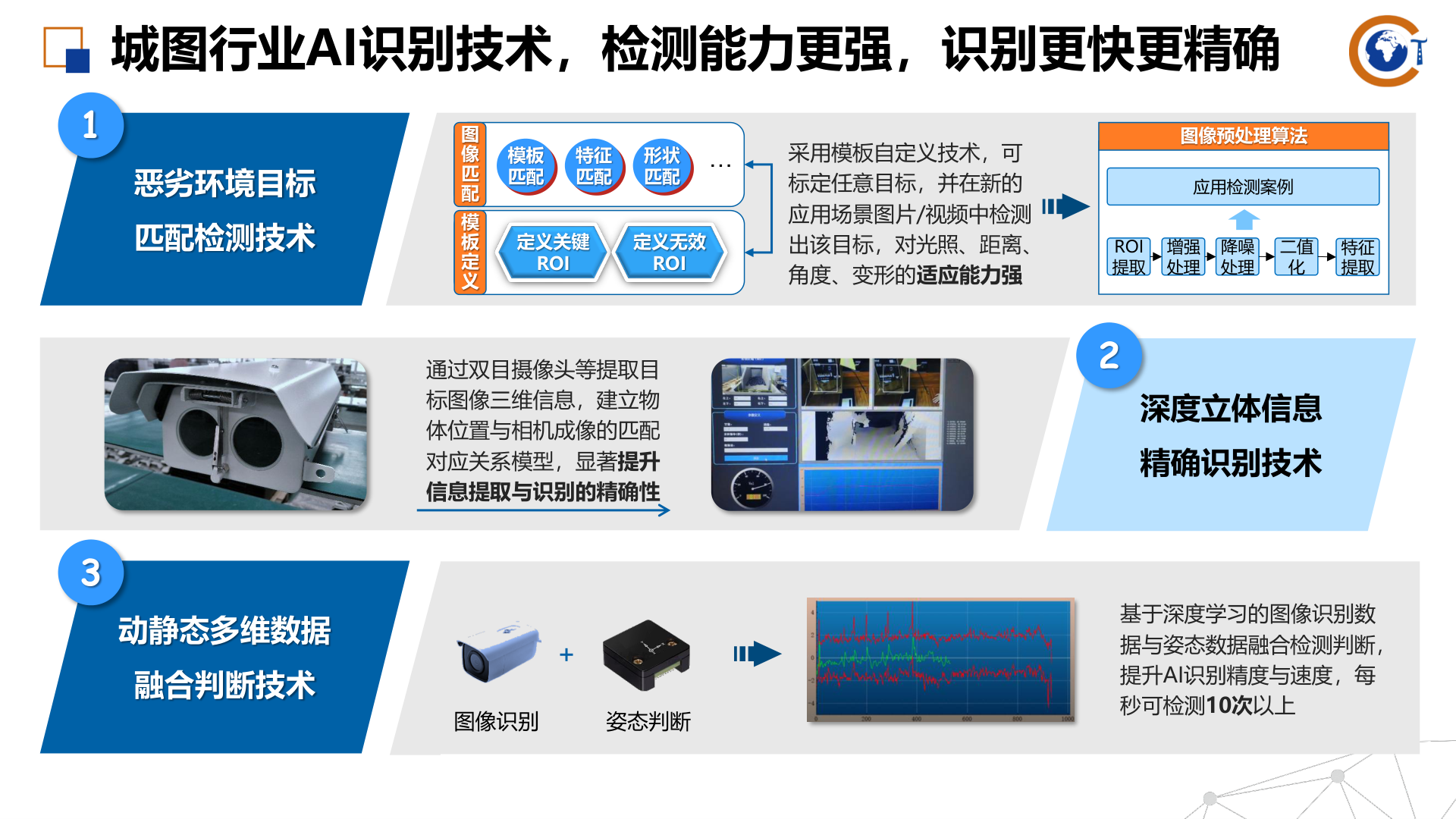
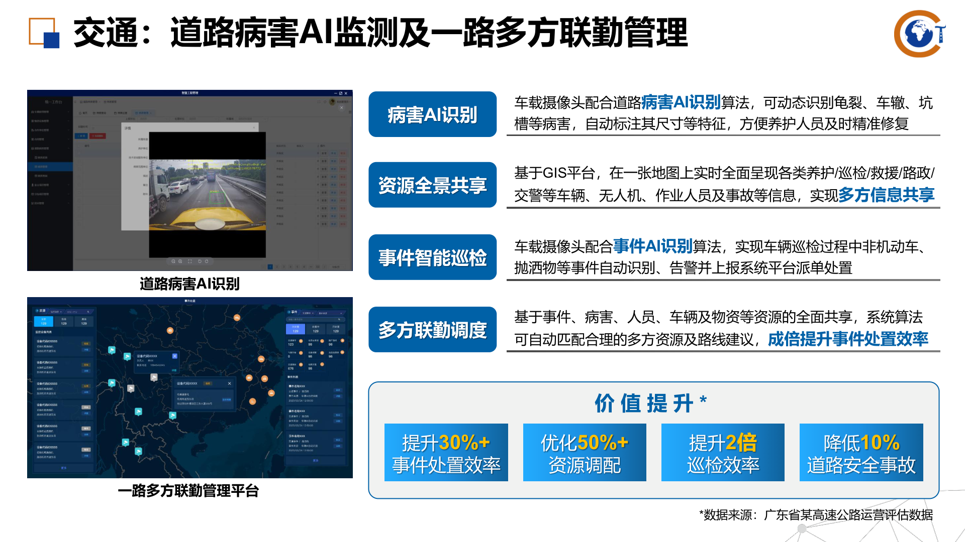
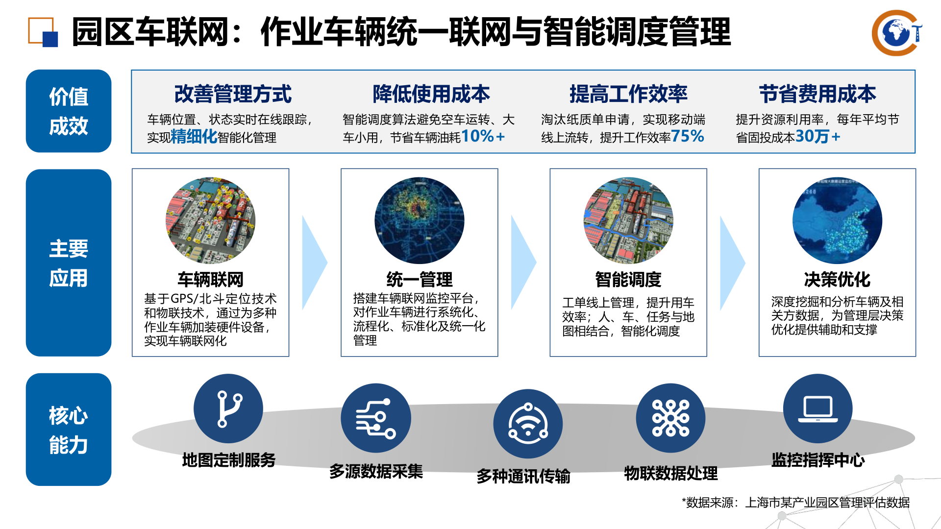
Its overall solution approach combines a self-developed enterprise digital platform, proprietary GIS engine capabilities, multi-source data processing, and industry AI recognition technologies to deliver end-to-end digital transformation support. The objective is to improve visibility, resource coordination, decision efficiency, remote monitoring, and intelligent operational control across complex business environments.

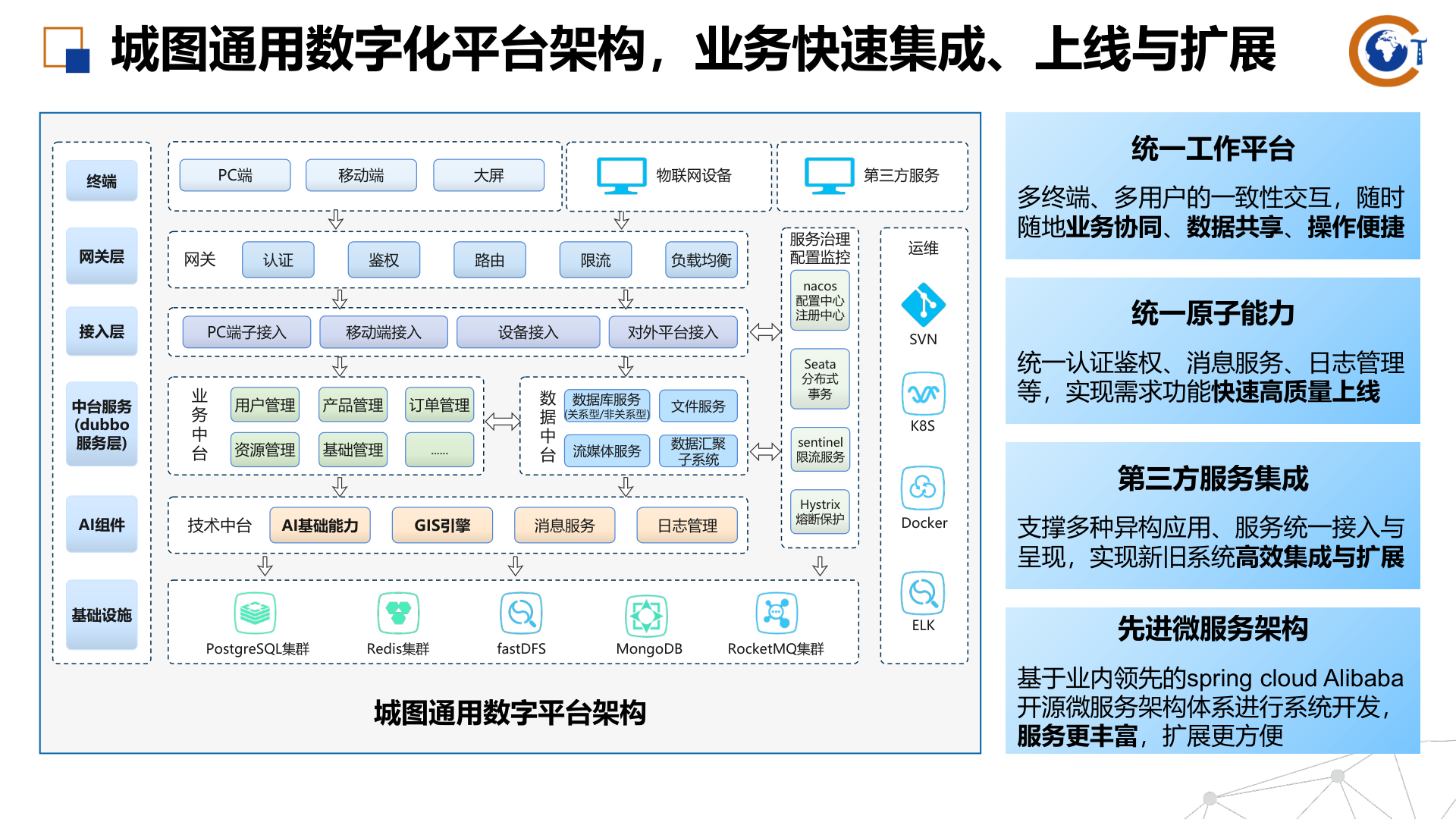
CityMap’s enterprise digital platform architecture for unified business integration, deployment, expansion, and multi-terminal collaboration.

AI recognition capabilities for target detection, visual judgment, template matching, and high-precision image-based monitoring.
| Platform architecture | Unified work platform, gateway layer, access layer, mid-platform services, AI components, GIS engine, messaging services, file services, logs, and infrastructure support for scalable deployment. |
| Technology foundation | Microservice-based architecture using Spring Cloud Alibaba concepts with service governance, configuration center, registry support, containerized deployment, and multi-database integration. |
| Core AI capabilities | Image recognition, posture analysis, image matching, template matching, ROI-based preprocessing, and dynamic or static anomaly detection. |
| GIS capabilities | Proprietary GIS engine, spatial data collection and editing, modeling, processing algorithms, 3D visualization, map dispatch, GIS monitoring, GIS alarms, and visualized work-order analytics. |
| Sample performance indicators | AI detection speed above 10 detections per second in some scenarios, support for 8+ instrument categories, recognition of 5+ road-defect types, and mine-cart derailment detection accuracy above 95 percent with response time below 1 second. |

Road AI monitoring and coordinated dispatch scenario using GIS, vehicle-mounted cameras, and event recognition algorithms.
CityMap smart city and industrial IoT solutions are suitable for organizations seeking stronger digital visibility, map-based operational control, AI-assisted monitoring, and data-driven decision support. Typical user applications include telecom digital sales systems, power-grid visualization and emergency support, road defect AI inspection, smart transport dispatch, engineering project management, industrial vehicle networking, mine safety monitoring, high-temperature environment monitoring, and robot inspection in power, road, fire, and industrial park scenarios.
The solution is especially suitable for customers that need to combine GIS, AI, IoT connectivity, and digital twin technologies into a unified operational platform that can scale across multiple business units and field environments.

Vehicle networking and intelligent dispatch platform example for industrial and park-based connected operations.